Trip Planning


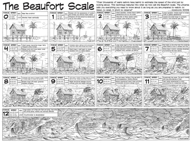
Being safe on the water begins with good planning. Knowing the forecast and understanding what those conditions look and feel like on the water are the key to having an enjoyable paddle.
Here are some great online resources we use:
 Perhaps the BEST one stop shop for trip planning is provided FREE by
Bay Area Sea Kayakers (BASK)
 Tidal Currents
San Francisco Bay - Golden Gate Bridge (0.8 mile east of)
Great explanation of tides in SF Bay
Swell & Wind Wave Heights
San Francisco Bay (North of Bay Bridge)
Bodega Bay (48NM NW of San Francisco)
18nm West of San Francisco buoy data
 Wind Speeds & Direction
Charts
Chart of San Francisco Bay Entrance

River Flows
Launch Sites
